Vodafone working on drones to restore mobile signal if masts go down
The mobile operator has carried out a trial of drones carrying light beam technology from Alphabet’s X labs.
Drones equipped with special light beams could be used to reconnect mobile phone masts when the underground cable linking them is cut or damaged.
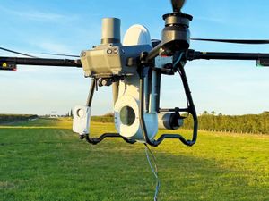
Mobile operator Vodafone has carried out a trial in Spain of concept technology from Google parent firm Alphabet’s X labs which uses light beams to carry connectivity, using it to create a temporary connection between two points over three kilometres apart.
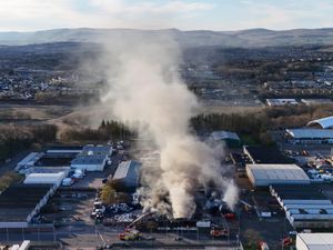
The firm said it demonstrated how a temporary mobile connection could be recreated in the event that the underground cables linking phone masts are cut or damaged – whether it be accidentally through building work or as a result of a natural disaster, or through vandalism.
In its test in Seville, two industry-grade drones were equipped with light beam terminals from a Google X project known as Taara, with one drone tethered to a phone mast and the other to a Vodafone data transport hub.
The operator said it was able to establish a two-way connection for a short period, and could offer a solution in the future to help with connectivity issues during emergencies or disaster recovery, as well as aiding with future infrastructure challenges.
Vodafone said it was currently dealing with between 75 and 100 cable breaks each year.
The mobile operator will be showcasing the technology during the Mobile World Congress trade show in Barcelona at the beginning of next month.
The firm is also set to show off what it calls a weather sensing network that uses data gathered by the operator as it adjusts its mobile signal across Europe to compensate for heavy rainfall – which can weaken signal strength.
It said it was now working with the European Space Agency and the UK Government to gather accurate rainfall measurements and turn all the data into a weather map for areas that are out of reach of existing weather observation posts.