Political map of Dudley redrawn as areas switch wards and other wards change names
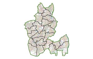
The political map of Dudley borough has been redrawn by the Local Government Boundary Commission.

Next May every councillor in the borough will be up for election. The number of wards will remain the same as will the number of councillors sitting on Dudley Council.
However, the boundaries of nine wards are being changed to take into account of various population changes of the various towns with some historical wrongs being righted.
The Brierley Hill ward will be called Brierley Hill and Wordsley South and the current Wordsley ward will become Wordsley North.
More than one third of addresses in the Brierley Hill ward are in Wordsley which left many feeling unrepresented. The Conservative Party lobbied the Boundary Commission for the name change and submitted a survey which showed 32.6 per cent of residents had Wordsley postal address, and 96 per cent of respondents agreed Brierley Hill and Wordsley South would be a more representative name for the ward.
Conservative Brierley Hill Councillor Adam Davies, who was elected in 2021, is delighted with his new ward's name.
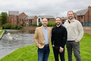
He said: "We are really pleased that the Boundary Commission has listened to the argument we have been making on behalf of local people.
"This new ward name finally reflects the fact that almost a third of households in the ward have a Wordsley address rather than a Brierley Hill address. We even have the Red House Glass Cone in our ward, which is about as Wordsley as it gets.
"We're proud to represent every community across Brierley Hill & Wordsley South, and are pleased that this new ward name finally represents the identity of the communities within it."
Cradley and Wollescote is being renamed Cradley North and Wollescote.
Residents in Cradley have resented how their area has either being mixed up with Cradley Heath, which is in Sandwell, or "being forgotten" by Dudley Council or their MP as they are part of the Parliamentary constituency of Stourbridge, which is traditionally Tory where Cradley has regularly voted for Labour councillors. However, Cradley South has been part of Hayley Green and Cradley South ward for decades and often votes Tory.
Labour Cradley and Wollescote Councillor Tim Crumpton said: "We've been called all kinds of things over the years, this will be my third change of boundary and ward name since I was first elected in 2002. They have changed the name to reflect that South Cradley is in a ward, but people just say they are from Cradley.
"For the majority of people these changes will not mean a thing, they don't care about boundaries, all they want is a decent service from Dudley Council because parts of Cradley has been let down for years and they would notice if this changed."
Lye and Stourbridge North will now include Belmont Road, Crabbe Street, Hill Bank, King Street and Pearson Street, which will be taken from Cradley and Wollescote.
The Foxyards estate and the houses between Blackthorne Road and Old Park Road are being moved from Castle and Priory ward to Upper Gornal and Woodsetton ward.
Dudley Road and adjoining streets from Gate Street to the rear of Valley Road are being moved from Upper Gornal and Woodsetton to Sedgley ward.
Professor Colin Mellors, chairman of the commission, Professor Colin Mellors said: “We are very grateful to people in Dudley. We looked at all the views they gave us. They helped us improve our earlier proposals.
We believe the new arrangements will deliver electoral fairness while maintaining local ties.”
For an interactive map is available at www.lgbce.org.uk/all-reviews/dudley.

