British artist creates amazingly detailed Lord of the Rings-style maps of West Midlands and Shropshire
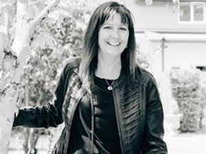
A few years ago Chris Birse, 35, was writing a fantasy novel and needed a fictional map drawn, but rather than "paying someone to do it" he gave it a go himself.
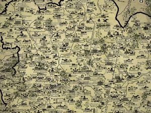
He was very happy with the results and Chris' map-drawing career could've ended there. But it didn't.
"For a bit of a laugh" Chris decided to draw a map in the same Lord of the Rings style for his own region - Teesside.
When that got a "really positive response" online, there was only one way to go. Things "spiralled" and he embarked on an impressive mission to produce Tolkien-esque maps of every region in the country, including the West Midlands - featuring a small but impressive Black Country section - and Shropshire.
He's since been able to quit his job in retail and take up fantasy map drawing as a full-time career.
His latest work - The West Midlands map - took him 80 hours to complete on Photoshop and the process required a large amount of feedback from local people. The Shropshire map went through the same lengthy process.
According to Chris, the feedback is an important part of designing these maps because it means he's able to include as much folklore as possible and cover areas with interesting stories that might be underrepresented on other maps, thus doing local communities justice while designing a map of a place he's not 100 per cent familiar with.
"It certainly is a lot of work," said Chris. "A good half of it is just going through people's feedback."
"I post in a lot of places, on Facebook and Reddit, so by the time I go through 1,000-plus comments that you get off people across all these platforms, it really does take a long time.
"If there's people who read this who have given me some feedback, I just want to extend my thanks to be honest, because I really couldn't do this, certainly to the level of detail without peoples' feedback."
The West Midlands and Lord of the Rings actually go hand-in-hand. Writer JRR Tolkien lived in Birmingham and many of the locations in the novels were allegedly inspired by the region. For example, it's regularly been suggested that the Black Country's heavy industrial past inspired his description of Mordor.
"I think with the West Midlands one [map], it's the fact that Tolkien lived there for a while," said Chris, describing one of the things he enjoyed about working on his latest piece.
"So I was able to get a lot of the locations in such as Perrott's Folly - I got the two towers in that allegedly inspired the two towers [in the LOTR novels] ... The other one I think was the Edgbaston Water Tower."
You can see the full West Midlands map below.
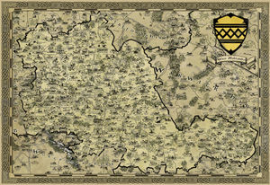
It's no wonder then that the West Midlands just seems to suit being presented in Lord of the Rings map form.
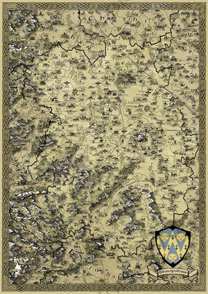
But Shropshire has fine folklore too, and that made it a prime location for one of Chris' fantasy maps.
"Going back to the Shropshire one [map], my favourite bit from that region was the mythology and the fantasy creatures that people highlighted - the Wrekin Giant being a favourite actually," he explained.
"I drew him sort of peeking around from behind the Wrekin and I think that's a really nice touch."
You can see the full Shropshire map below.
Chris sells his work on Etsy and describes them as the "ideal Christmas present."
"They come in three main sizes. They're all fairly large, given the sheer level of detail, so the smallest is actually in A3, then I do an A2 and an A1, and they're priced at £18, £20 and £24 respectively," he added.


