
Windy weather ahead for West Midlands as yellow weather warning put in place at weekend
Residents across the West Midlands have been warned to expect a day of heavy winds after a yellow weather warning was issued by the Met Office.
Watch more of our videos on ShotsTV.com
and on Freeview 262 or Freely 565
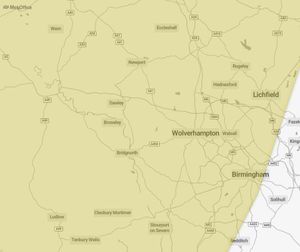
The Met Office has warned that strong winds are expected across Wolverhampton, Dudley, Walsall and Sandwell this weekend, with gusts of 50-60mph and as much as 70mph in exposed regions.
The weather warning was announced on Thursday morning (February 20), with the strong winds expected to begin at 3am on Sunday until 3pm on the same day.
The weather group has warned that strong winds may cause delays to road, rail and air transport around the West Midlands and parts of Staffordshire, as well as possible loss of power and other services in some regions.
A spokesperson for the Met Office said: "While Saturday should provide respite for many, Sunday will see more wet and windy weather sweep east across the UK. There’s a potential for further warnings on Sunday as details are firmed up in the coming days.
"Southerly winds are expected to increase through Sunday morning, peaking late morning to early afternoon with gusts of 50-60mph, and perhaps as much as 70mph on the exposed Irish Sea coastline and some other areas of high ground."
The group went on to warn those travelling in the West Midlands should check travel information and road conditions ahead of commuting, and to prepare for potential power cuts throughout the day.
For more information on how to stay safe during the yellow weather warning, visit the Met Office website.
West Midlands weekend forecast
Friday will see an unsettled day in the West Midlands region with outbreaks of rain, high winds and a mild temperature of 10 degrees.
Saturday and Sunday will see possible sunnier weather for most, with scattered showers across the area and temperatures dropping closer to average beginning next week.
See the full weather forecast for the West Midlands below:
Today:
Wet and windy with outbreaks of rain, heavy at times. Skies brightening somewhat in the afternoon but with lingering showers. Very mild but tempered by the wind. Maximum temperature 14 °C.
Tonight:
Drier during the evening with some clear spells initially. Cloud building overnight with rain returning in the early hours. Winds briefly dropping lighter but becoming windy again by dawn. Mild. Minimum temperature 10 °C.
Friday:
Another unsettled day with outbreaks of rain, heavy in places, and gales over hills. Becoming drier into the evening. Temperatures notably above the February average, but not always feeling so. Maximum temperature 14 °C.
Outlook for Saturday to Monday:
Sunnier spells possible on Saturday and Monday with scattered showers. A wet and windy Sunday in between. Mild over the weekend, then temperatures dropping closer to average next week.