West Midlands battered by storms as Hurricane Lorenzo approaches
Roads were flooded, trees uprooted and homes left without power as the remnants of Hurricane Lorenzo approached the West Midlands.
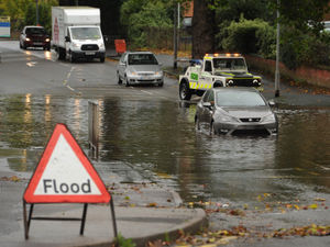
The West Midlands is braced for further downpours as the downgraded Atlantic storm arrives from the Azores by Thursday.
Met Office forecasters issued a yellow weather warning for rain on Tuesday with fears over flooding and possible travel disruption.
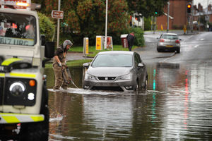
Two flood warnings were in place and 29 alerts across Staffordshire and parts of Worcestershire due to the inclement weather.
In Stafford, a particular flooding hotspot at Sandon Road was affected.
A breakdown service based in the area said it had rescued two motorists from the waters in the past three nights.

Gregory Burgher, managing director of Stafford-based GDB Recovery Limited, said: "Sandon Road has been flooding like that for the best part of 28 years.
"Sometimes the council puts on road closed signs and sometimes they don't. Sometimes people try their luck and get stuck, and other time they just about make it through.
"In the past three nights, there has been flash flooding and we have had to rescue two motorists. I would say in total this year, we have rescued 20 motorists."

There was also flooding at a set of roadworks and also at a water course in Victoria Park.
Old Park Road, in Wednesbury, was flooded with six inches of water covering the entire width of the street
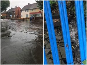
The water has since cleared but ward councillor Elaine Costigan alerted Sandwell Council's highways department.
The councillor said a damaged drain nearby needed further examination to ease potential flooding going forward.
"It is a shame as there's a school [Old Park Primary] close by and that's why I called as there's children having to walk that way," she said.
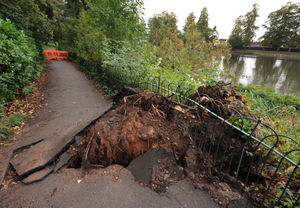
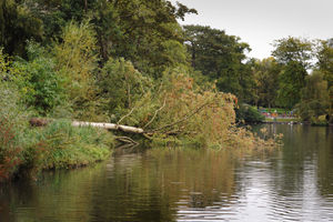
At Mary Stevens Park, Stourbridge, a tree was blown over in strong winds, blocking a footpath.
It resulted in the tree roots breaking up the footpath.
Orange barriers were placed on the footpath to prevent access.
Dudley Council cabinet member, Councillor Karen Shakespeare, said the park pathway has been closed and the area made safe.
"We are now making plans to remove the tree before repairing a small section of path and fence," she said.
Meanwhile, more than 900 homes were left without electricity after a power cut in Cannock on Monday night.
A total of 913 properties were affected by the issue, which was caused by a cable fault, in the Cannock and Burntwood area just after 10pm last night(30).
The power was back on by 10.45pm, according to Western Power Distribution. It is unclear what had led to the cable fault.
WATCH: Latest weather forecast
Forecasters said some areas are expected to receive the equivalent of two weeks worth of rain in less than an hour.
And forecasters say that a brief respite from the deluge on Wednesday will give way to even more heavy rain and wind later in the week when the remnants of Hurricane Lorenzo work their way across the UK.
Meteorologists have said the slow moving clouds on Tuesday could bring rainfall totals of as much as 40 to 50mm in a couple of hours in some places.
Met Office spokesman Grahame Madge said: "This could lead to the potential for flash flooding quite quickly."
Mr Madge said the heavy downpours will die out tonight when a ridge of high pressure will see plummeting temperatures with the potential for a grass frost in some areas of the north.
But he said that a day of fine weather on Wednesday will then give way to further wind and rain as what is left of Hurricane Lorenzo - the huge storm currently threatening The Azores - lashes the UK from later on Thursday.
These new storms come as large parts of the north of England and Midlands continue to deal with flash flooding from the heavy rain of the last few days.


