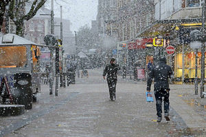
Snow, sleet or hail possible as Arctic blast heads to the West Midlands
Wintry showers could hit the West Midlands on Tuesday as a blast of Arctic weather travels across the UK.

Met Office forecasters say snow, sleet or hail could hit just about anywhere in Britain over the next 36 hours, although any snow is unlikely to settle on lower ground.
The northern hills are most likely to see snow as the cold weather moves south from Scotland, where the white powder has already fallen.
The Met Office issued a warning for northern Scotland before the snow arrived on Monday morning and began to edge south.
Met Office spokesman Grahame Madge said the air moving over Britain from the Arctic will bring large thunder clouds which could result in hailstorms, thunder and lightning as well as the possibility of sleet and snow flurries.
He said: "As we go over the next 36 hours those wintry showers will become quite frequent.
"There's a possibility of wintry showers just about anywhere in the UK tomorrow but more likely is that people anywhere, really, could see hail."
Mr Madge said: "In the south, it's possible the people could see sleety rain or hail for some time but we're not likely to see any accumulation or settling.
"The more at risk areas for seeing snow are obviously the northern hills and we could possibly see some settling as far south as places like the the higher tops on the North Yorks Moors.
"But, generally, what we'll see in those very showery conditions is that when it starts to rain, it'll drop the temperature maybe enough to trigger the development of sleet or even the odd snow shower for a time."
In the Black Country and Staffordshire brisk northerly winds will add to the cold feel on Tuesday, according to the Met Office, with temperatures unlikely to feel warmer than 2C despite a potential high of 8C.
Mr Madge said the colder weather will also bring plummeting temperatures at night.
He said: "By day, the temperatures won't be too bad. Really, it's the night time temperatures that are going to be quite cold.
"We will see widespread frosts, possibly anywhere, particularly in inland areas.
"These could be quite sharp in places so, obviously, there's an additional warning to gardeners and horticulturalists."
Mr Madge said late April snow was not unusual. He said: "It's possibly created a bit of a surprise for people because we've had such a mild March.
"I think it was the fifth mildest March in the record going back to 1910.
"So, I think the fact we've got cold weather in combination with a warm March is probably a bit of a shock for people.
"This is a sudden, brief interlude but it's not unusual."
The Met Office is expecting the weather to warm-up towards the end of the week.


